Archaeologist, MSc, RPA

Steven is an international Archaeologist and GIS Specialist with proven ability to develop and manage large, commercial and technologically grounded archaeological/environmental projects. He has a Master's degree in Maritime Archaeology from the University of Southampton, England and is a certified AAUS & ESDP Scientific Diver. He is dedicated to the preservation of cultural heritage and delivering professional archaeological services with expertise.
International Archaeological Projects
Cala Cativa II Excavation
Excavating a 2nd Century BC shipwreck at 30 meters (100 feet), performing accelerated decompression dives twice a day in the Catalonian region of Spain. Dr. Carmen Obied (Left) and I (Right) are removing sediment with a water dredge from the 2000 year old wooden remains of a Roman merchant ship. Credit: D. Selmo

Maritime Archaeological Survey of Cap de Cavalleria | Menorca, Spain. Credit: P. Bachpol

Maritime Archaeological & Ecological Survey | Zadar, Croatia. | I.C.U.A. | Credit: L. Pape

Maritime Archaeological Survey | Zadar, Croatia | I.C.U.A | Credit: P. Campbell

M.A.S.O
Project director of photography and videography for the Maritime Archaeological Survey of Oman (MASO). Directed a team of underwater archaeologists in filming and photographing the extraction of a 9th century anchor off the coast of Mirbat Oman. The video is currently held by the Ministry of Culture and Heritage of Oman for training Omani archaeologists in underwater artifact extraction. Credit: R. Bynoe

Langstone Barge Intertidal Survey Langstone, England | Credit: L. Johansson

Langstone Barge Intertidal Survey Langstone, England | Credit: S. Lopez

Maritime Archaeological Survey of Oman (M.A.S.O.) | Mirbat, Oman.
Maritime Archaeological Survey of the Port of Sanitja
Preparing a transect tape with a team of six underwater archaeologists to conduct a circular survey around some previously identified Roman Amphora cargo off the Island of Menorca, Spain. Clear underwater communication during an activity such as this is vital for a successful survey. Our team located several more cargo pieces that eventually led to a larger concentration of cargo from a Roman merchant ship.


Maritime Archaeological Survey of Cap de Cavalleria | Menorca, Spain | Credit: P. Bachpol

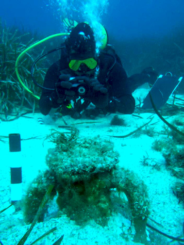
Maritime Archaeological Survey of Oman (M.A.S.O.) | Mirbat, Oman
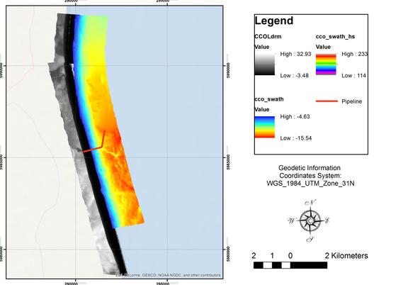
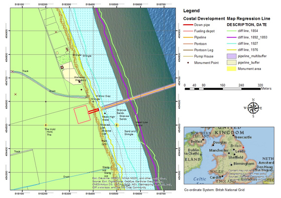
Geographic Information Systems
GIS Specialist


Photogrammetry and Technical Drawing

Photogrammetric model of the Langstone Barge created in Agisoft Photoscan.

Technical drawings of a Dartmouth Gig digitized within Corel Draw: top view, side view, and cross sections.

Top: Hand drawn technical drawing of a Dartmouth Gig | Bottom: Technical drawing of Dartmouth Gig scaled and digitized in CorelDRAW.

Site Plan for Langstone Barge Intertidal Survey. Created using CorelDraw.